
Meteorologists Closely Monitor Milton’s Path and Urge Residents to Secure Properties and Follow Safety Advisories
By: Angela Redding | Los Angeles, CA | Hollywood Beat magazine | October 8, 2024
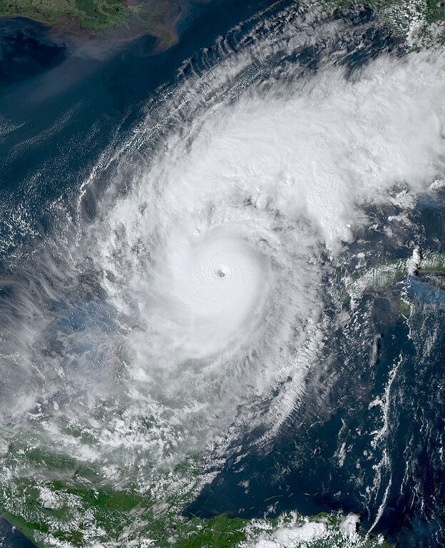
Photos: National Hurricane Center and Government of Florida
Hurricane Milton has reached a catastrophic Category 5 status, which indicates maximum sustained winds exceeding 157 mph and intense low-pressure systems that can result in devastating impacts on communities.
Storm’s Powerful Winds and Torrential Rainfall Pose Severe Threats

As it approaches landfall, the storm’s powerful winds and torrential rainfall pose severe threats to coastal regions, prompting urgent evacuations and preparations for potential disasters. Meteorologists are closely monitoring Milton’s path, offering critical updates while residents are urged to secure their properties and heed safety advisories issued by local authorities.
In such a powerful hurricane, the risk of storm surge, flooding, and widespread damage is alarmingly high, emphasizing the need for readiness and resilience in the face of this natural calamity. Furthermore, the impacts of Category 5 hurricanes can be long-lasting, affecting infrastructure, economy, ands the lives of those in the affected areas for years to come.
Hit Landfall by Wednesday
The actual path of the storm is not known but it is expected to reach landfall by Wednesday night near Florida’s Central Gulf Coast.

CBSNEWS reported that on Monday, officials issued mandatory evacuation orders for specific areas in Tampa. As apart of Hillsborough County (Tampa), authorities have announced the opening of nine shelters across the county to accommodate residents in mandatory evacuation zones, as well as those at risk of storm surge, flooding, and wind damage.

Gov. Ron DeSantis
Florida Governor Ron DeSantis emphasized that residents face a critical and limited time-frame to implement their evacuation plans in advance of Milton’s impending landfall.
Hollywood Beat magazine


Related Stories

Leave a Reply